OGC Standards Program
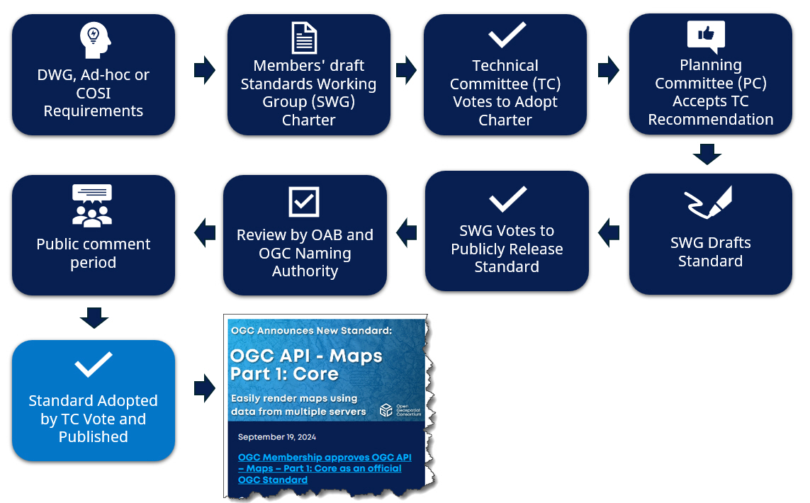
A dynamic, rigorous process is behind the creation of every OGC Standard. It starts with our working groups, connecting with each other through a dedicated Member Portal.
Following our Technical Committee’s procedures, Domain Working Groups and Testbeds identify domain-specific requirements for interoperability while Standards Working Groups bring interoperability requirements forward as standards for adoption.
As standards are developed, code sprints iteratively test the work.
Code sprints are venues that test draft standards and software solutions that implement against them. Standards-based solutions are put through real-world scenarios to document their use in a context understandable by the wider community.
Compliance tests are run to ensure that software and systems are reliable and interoperable through adherence to OGC standards.
There are three types of standard:
- Encoding standards provide rules that determine how to organize information, typically sent by a service provider, or produced by an application.
- Interface Standards provide rules that determine the operations between service providers and service requesters. Together, these standards define interoperable approaches to geospatial data organization, access, processing, visualization, and discovery.
- Conceptual Model Standards describe common concepts and their relationships to facilitate exchange of information between parties within a specific domain..
There are three levels of standard:
- Community Standard: This is a document, developed by communities external to the OGC, that OGC members wish to bring into the OGC process. The key consideration for a Community Standard submission is that there is very strong evidence of implementation.
- Draft Standard: This is a document developed by the OGC membership for which there is no evidence of implementation. Members seek to approve it as an official OGC document in order to have developers and organizations implement the Draft Standard and provide feedback. A Draft Standard becomes a Standard once evidence for implementation is provided.
- Standard: This is a mature OGC Standard for which there is evidence of implementation.
Standards are dynamic: They evolve as technology changes and are retired when they’re no longer in use. For example, OGC’s Web Service Implementation Standards have evolved into modern web APIs. OGC APIs make it easy for anyone to leverage geospatial information on the web and to integrate it with other types of data. To track such changes in real time, we roadmap Standards development. The Standards are managed through a well-defined lifecycle.