Hexagon’s long-time support of OGC and our Standards, including our family of OGC APIs, has enabled the Company to learn from, collaborate with, and support the broader geospatial community, while also improving their product offering and being one of the first to market with support for the latest generation of geospatial standards.
“Hexagon has had a storied history in OGC, beginning with Intergraph, the first commercial member. As other members like Leica Geosystems, ERDAS, Ionic, and Luciad have come together into what is now the Hexagon membership, we continue to see a great benefit to our involvement in OGC,” said Stan Tillman, Executive Manager, Hexagon’s Safety, Infrastructure & Geospatial Division. “In particular, we are Principal members in order to provide our insight to innovation and help OGC remain relevant in the geospatial world. But our membership in general allows us to learn from others in a truly collaborative environment involving development and management.
“The work with the OGC API – Processes group is a prime example: as co-chair of the group, Hexagon has helped drive the new RESTful APIs knowing this is the direction of the developer community. However, our involvement in this group has helped us learn from others in the group, involve our developer community sooner in the process, and help in planning the next phase. This give-and-take environment provides a safe place to collaborate, which is often missing in the external communities.”
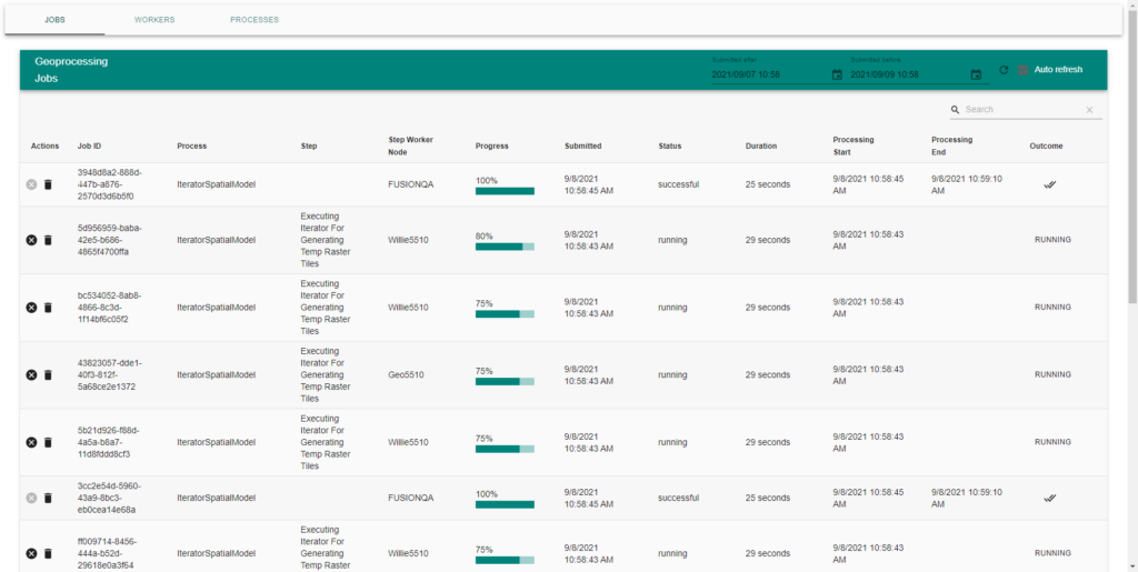
As a fruit borne of this involvement, Hexagon recently launched a new suite of products – the Power Portfolio 2022 – which is one of the first offerings on the market to support OGC API Standards. The suite includes Geoprocessing Server 2022 (as part of the ERDAS APOLLO product), which exposes its APIs using an early version of the OGC API – Processes Standard. ERDAS APOLLO also includes a web-based map client, called Catalog Explorer. Catalog Explorer already supported OGC standards like WMS, WFS, WMTS, and OGC 3DTiles, but new to this release is an OGC API – Processes dynamic client interface and support for OGC API – Features.
“Hexagon is excited to see the interest in its new Geoprocessing Server from both our customers and partners. The new Geoprocessing Server empowers many more end users at the organization to create value-added data products leveraging Spatial Models or processes from other processing engines. The aim is to leverage those experts but enable any user to execute them with nothing more than a web browser and data sourced from the catalog. Not only does this increase accessibility, but it will also, in many cases, mean the outputs are created faster by utilizing more powerful server hardware, deployed closer to the data sources.
“It has been said before, but data is one of the few assets an organization has that becomes more valuable the more it is used. This is why we see geoprocessing as an important tool: it gives value to your data.”

“For several years, Hexagon has maintained a visual tool for building geoprocesses, so geoprocessing is certainly not foreign to the Hexagon community,” said Stan. “This capability has been exposed through internal interfaces and even OGC Web Processing Service (WPS) to a limited extent. Over the last year, we have been developing a standalone, highly scalable service to be used in executing these processes, but we were not thrilled to expose this service through the xml-based WPS. The stars started to align when OGC changed its focus to a more RESTful based approach with standards defined with REST interfaces and using geojson. We felt this fit much better in our roadmap as it pertained to geoprocessing.”
OGC API – Processes is just one Standard from the new family of OGC API Standards being developed by the OGC Community. OGC API Standards define modular APIs that spatially enable Web APIs in a consistent way – making them “building blocks for location.” OGC API Standards make use of the popular OpenAPI specification, so are easy to implement and access.
“Regarding the benefits of developing interfaces based on OGC API – Processes, we see positive gains on both the backend and frontend,” continued Stan. “First, the development of the APIs has been very easy to pick up by developers that may not have had a lot of exposure to OGC in the past. Lots of tools are available to help with auto-generated code and the use of OpenAPI Specification 3.0 has been a valuable way to provide an abstracted access to our service.
“Secondly, and maybe even more important, is the benefit of easy integration. We were able to build the Geoprocessing Server as a standalone component so other groups within Hexagon could take advantage of its use. Exposing our interface using OGC API – Processes helps us to share within our own division, but we have also found it makes it easier to convince other divisions to implement based on an international standard rather than a home grown approach.”
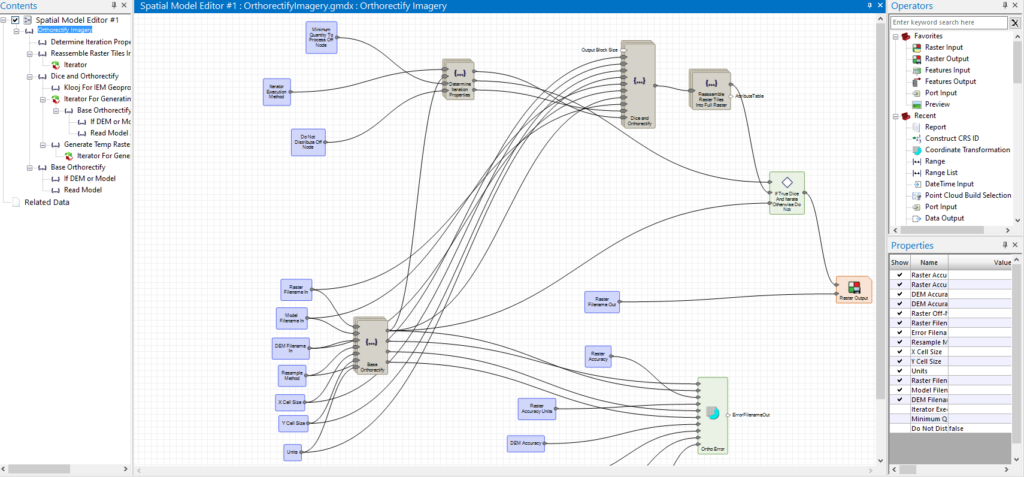
Hexagon also recently participated in the July 2021 OGC API Virtual Code Sprint (Engineering Report here). To ensure that all of the new OGC API standards are as developer-friendly, usable, and mature as possible before release, each draft specification is being put through one or more code sprints to test and improve their ‘readiness’ before starting the OGC standards approval process. At the Sprint, Hexagon’s Steven McDaniel demo’ed the integration of OGC API – Processes into Geoprocessing Server and Catalog Explorer and how they enable anyone in an organization to easily run geospatial processing models built in the visual workflow builder, Spatial Modeler.

“By participating in the Sprint, we were able to quickly get answers to questions pertaining to the specification and test/compare our implementation real-time with other implementations,” said Stan. “One-on-one discussions with the specification creators and other implementers helped us better understand the specification. Hopefully, our input helped to smooth out the rough points in the specification and its documentation. Our participation also led to a few new capabilities needed in the specification that Hexagon felt were minimum requirements within our product’s implementation.”
With such a long history at OGC, it’s great to see that Hexagon still gains so much from, and contributes so much to, membership in the OGC Community. From their collaboration with geospatial experts, to providing and gaining insight into early technology trends and standards development, OGC is proud to count Hexagon among its Principal Members.
