
















Making the World
Work Better Together
A global community where people solve shared geospatial challenges
and build the standards that make systems work together.


Solving Shared Geospatial Challenges
Built Together.
Trusted Everywhere.
For more than 30 years, OGC has been in service to its members, bringing together government, industry, academia, and innovators to solve shared geospatial challenges. Technology has evolved from web services and APIs to AI, digital twins, and low Earth orbit. Our purpose has remained the same: helping people make location information more accessible, interoperable, and impactful. When members solve shared challenges together, the standards and the impact follow.
Get Involved
Connect
Connect with the global geospatial community. Find peers, exchange ideas, and discover opportunities to collaborate.
Build
Work with other OGC members to solve shared problems and develop technologies and standards that work across systems, organizations, and industries.
Apply
Apply what the community creates. Put proven solutions into practice and bring your experience back to help shape what’s next.
Four Ways to Engage
Whether you’re developing new technologies, validating standards, or connecting with the global geospatial community, OGC offers multiple ways to get involved. Participate in collaborative innovation through Testbeds, tackle real-world challenges with Pilots, build and experiment at Builder Days, and connect, learn, and share at Events.
Testbeds
Our largest collaborative initiatives bring sponsors together to tackle the geospatial challenges of tomorrow—from AI and digital twins to low Earth orbit and beyond.
Pilots
Short, focused initiatives that demonstrate new concepts, specifications, and emerging standards in real-world environments—turning promising ideas into proven solutions
Build
Join a Domain Working Group to explore challenges and requirements, a Standards Working Group to develop OGC Standards, or participate in Builder Days to build, test, and improve implementations together.
Events
From OGC Connect to OGC iDays, our events bring together the people shaping the future of geospatial. Build standards, explore new technologies, share what’s working, and connect with the people moving the field forward.
MEMBER COMMUNITY
Meet the Community on Agora
Agora is OGC’s online community, where members connect, join discussions, participate in working groups, find resources, and stay close to the work shaping standards and interoperability.
Available on the web and mobile, Agora connects you with peers across government, industry, academia, and the global geospatial community.
Join OGC and join the conversation.
What the Community is Working On
Emerging priorities
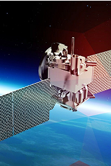
- Virtual Constellations
Tasking dozens of satellites through a single interface - Metadata ecosystems
Connecting people, applications, and AI to the data they need - Semantic interoperability & linked data
Making data AI-ready by design
In Action
- MUDDI / NUAR
Interoperable underground asset data - FMSDI
Marine spatial data infrastructure - DGGS & AI
Global-scale analysis and AI applications - 3D Tiles
Streaming massive 3D geospatial datasets
Testimonials
Member experiences that highlight the value of open standards, shared learning, and global partnership.
At Hexagon, that translates into real business value: solutions that are interoperable by design and aligned with global ecosystems. This is why being a Principal Member is a no-brainer, we turn collaboration into a strategic advantage for our customers. Through OGC, Hexagon helps turn standards into scalable, real‑world digital reality solutions.”