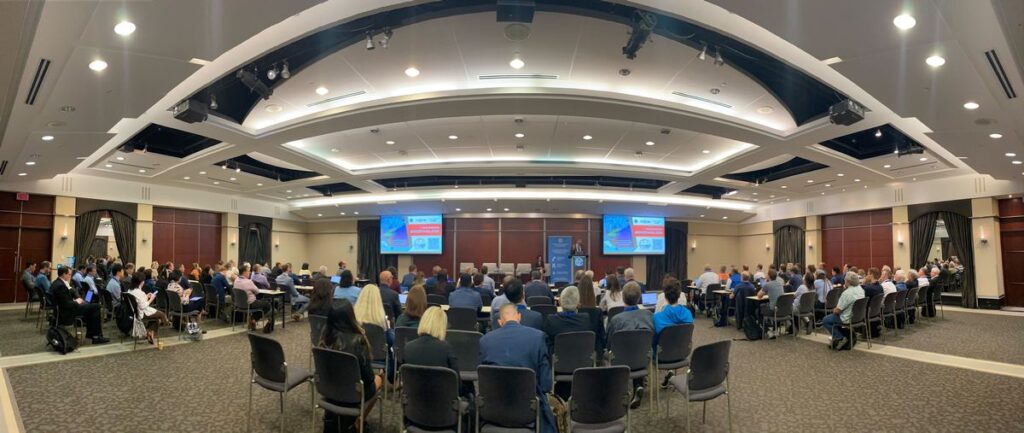
The 129th OGC Member Meeting was held in Montreal, Canada, from June 17-21, 2024. The meeting was hosted by OGC Strategic Member Natural Resources Canada, with additional support from Esri Canada, CAE, Safe Software, and Bentley Systems. The week saw more than 200 leaders and experts from industry, academia, and government come together—with a further 100 online—to learn about the latest innovations from OGC Members, advance Standards, network, and shape the future of geospatial technology. The meeting was also notable as it marked the beginning of OGC’s 30 year anniversary celebrations, which will culminate at an event in Washington, D.C., this December.
Under the theme “Standards enabling collaboration for global challenges” the 129th Member Meeting focused on discussing, aligning, supporting, and promoting geospatial solutions that address challenges as far reaching as climate change and related disasters, and application domains as diverse as marine, Artificial Intelligence/Machine Learning (AI/ML), and beyond.
Alongside the many OGC Standards and Domain Working Group meetings, there also included a Methane Summit, a Sensor Summit, a two-day meeting of the Canada Forum, a Quantum Computing ad hoc, a Metadata Workshop, and the kickoff of Testbed-20.
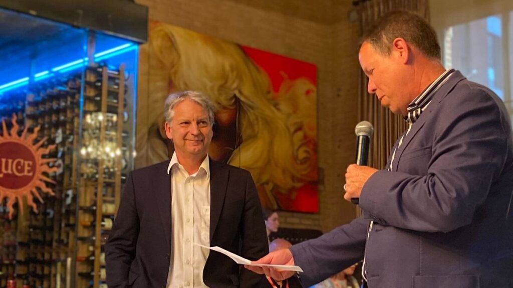
Friday’s OGC Executive Planning Committee Meeting was hosted by CAE at their nearby factory, and included a memorable tour of their factory floor. Social occasions included a Monday evening reception and a Wednesday night dinner was held at Northern Italian restaurant, Le Richmond. During the dinner, Andreas Matheus from Secure Dimensions GmbH was presented the 2024 Gardels Award for his persistent efforts to ensure best practices in security and API design in OGC. Congratulations, Andreas!
In addition to the challenges and domains covered by the meeting theme, two additional areas of discussion that stood out during the week: Digital Twins & Sensors, and Ethics in Geospatial.
Digital Twins & Sensors. OGC members are increasingly demonstrating the use of digital twins of the built environment (e.g., city and building models) as the context and framework in which sensors are managed. Sensed information in the real world can be displayed on digital representations of that digital reality to enable better understanding of environmental conditions, human activity, and system responses to those factors. The Urban Digital Twins DWG, 3D Information Management DWG, and the Autonomy, Sensors, Things, Robots, and Observations DWG are each actively discussing and collaborating on this integration.
Ethics in Geospatial. The OGC Executive Planning Committee has established a new subgroup on Ethics in Geospatial to set strategy for how OGC might address/respond to the ethical use of geospatial data or the use of those data for ethical purposes. The group will organize an initial meeting this July. If you would like to contribute to the conversation, you can sign up to the OGC Ethics in Geospatial email list here.
Opening Plenary
The Opening Plenary was hosted by OGC’s Dr. Rachel Opitz and featured a keynote presentation from Eric Loubier, Director General of the Canada Centre for Mapping and Earth Observation at Natural Resources Canada. Mr. Loubier highlighted the use of geospatial data and technologies to address the needs of Canadian citizens, with examples including flood and wildfire risk.
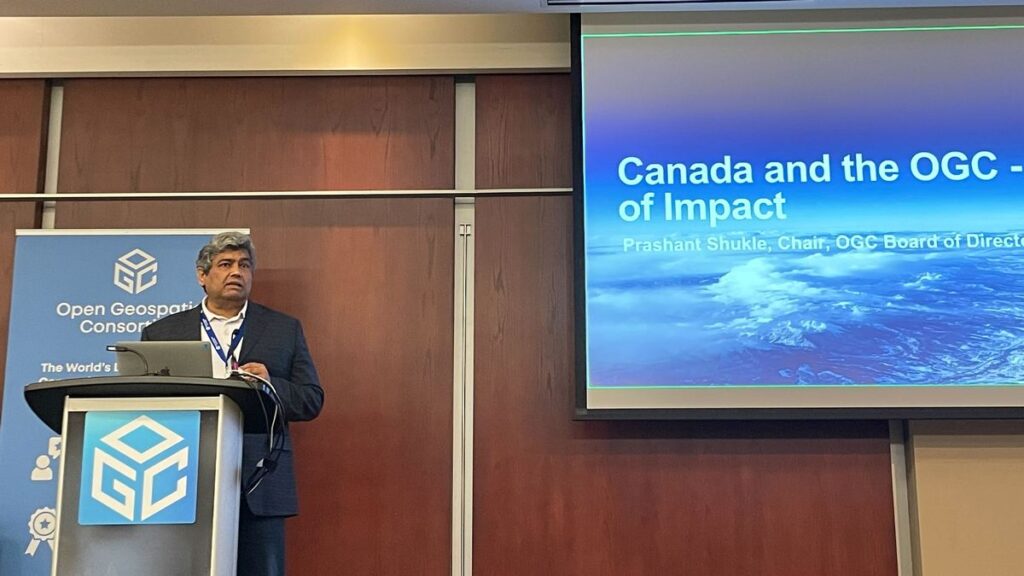
Introductory messages were then delivered by Louis-Martin Losier from Bentley Systems, Gordon Plunkett from Esri Canada, Hermann Brassard from CAE, and Dean Hintz from Safe Software. Finally, Prashant Shukle, Chair of the OGC Board of Directors, presented on “Canada and the OGC – 30 years of impact,” which reflected on the important parts that Canadian organizations have played in OGC’s 30 year history.
Special tribute was then paid to an instrumental figure in OGC’s history who sadly passed away in May this year, Dr. John Herring. John was OGC’s first Gardels Award recipient back in 1999, and also received an OGC Lifetime Achievement Award in 2022.
Future Directions
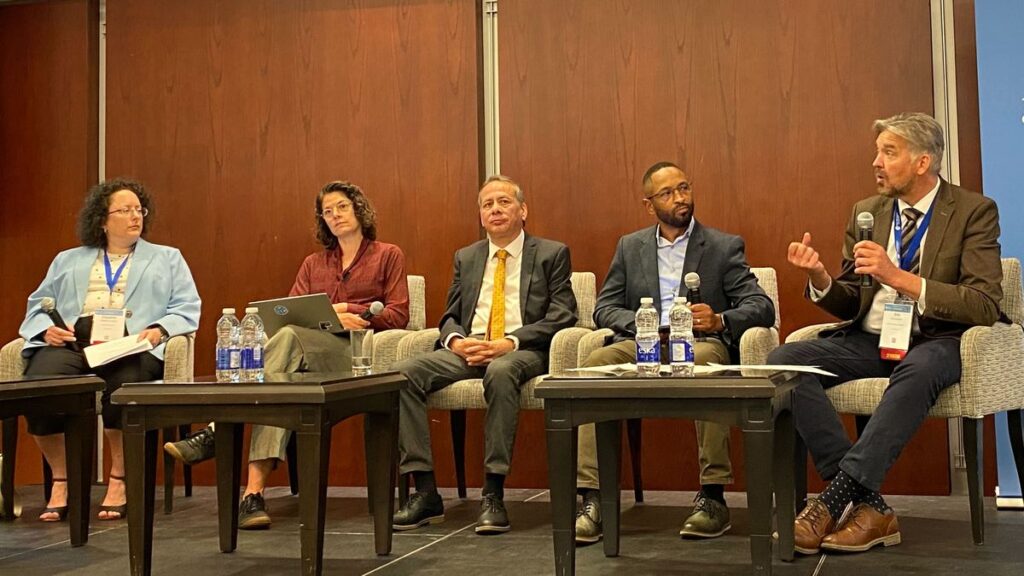
This Meeting’s Future Directions session focused on Artificial Intelligence in Geoinformatics. Four presentations were made to provide updates since this topic was last addressed.
- Leveraging AI for Geospatial Reality Data: Louis-Martin Losier, Jeroen Vermeulen, Arnaud Durante (Bentley Systems)
- Spatial Web: AI agents operating in hyperspace: George Percivall (GeoRoundtable / IEEE GRSS)
- A User-Centric Process to Build AI-Powered Geospatial Applications: Pablo Fuentes (makepath)
- Bringing Geospatial Awareness to Large Language Models Using Spatial Knowledge Graphs: Nathan McEachen (TerraFrame)
The four presenters then engaged in a fascinating panel discussion moderated by Dr. Gobe Hobona of OGC. OGC Members can access the presentations and a recording on this page in the OGC Portal.
Meeting Special Sessions
The Methane Summit focused on the observation, measurement, monitoring, and spatial analysis of methane emissions. Consistent reporting of these emissions in a spatial context is key to effective decision making regarding reduction of emissions and their environmental consequences. Hence, the session also resulted in the proposal of a new OGC Standards Working Group (SWG) for EmissionML as a means to encode emission data. OGC Members can access the presentations and a recording on this page in the OGC Portal.
Directly following the Methane Summit was a linked Sensor Summit to talk more specifically about sensor model and data standardization. The focus of this Summit was on new and emerging Standards activities in OGC, including SensorThings API version 2.0, OGC API – Connected Systems and its dependent updates to the SensorWeb Standards, and the UK SAPIENT sensor architecture. OGC Members can access the presentations and a recording on this page in the OGC Portal.
The OGC Canada Forum held sessions on both Monday and Tuesday. Day 1 included an opening and the Forum Overview, followed by a panel on “The Transformative Role of Industry in National Geospatial Strategy and Spatial Data Infrastructure.” Day 2 started with an Oxford debate on the impact of standards on innovation and then included a panel on “National Geospatial Strategy in a Time of Rapid Change and Growing Challenges.” The day wrapped up with a discussion on partnerships and a closing. OGC Members can access the presentations and a recording on this page in the OGC Portal.
The Quantum Computing ad hoc session was a follow-up from the previous Member Meeting to assess whether a new OGC Working Group should be established to assess the geospatial role of quantum computing technologies. OGC Members can access the presentations and a recording on this page in the OGC Portal.
On Friday of the meeting week, a full-day Metadata Workshop was organized by the Metadata and Catalogs Domain Working Group (DWG). The first half of the workshop set the stage with presentations on current and emerging metadata Standards as well as their practical use. The second half of the summit was focused on the candidate OGC GeoDCAT Standard, how GeoDCAT fits within OGC’s building block approach to Standards, and preparation for a metadata-centric OGC Code Sprint later in 2024. OGC Members can access the presentations and a recording on this page in the OGC Portal.
The next OGC Testbed has now begun! The Testbed-20 kickoff session helped participants better understand sponsor requirements and introduced both parties to the process by which OGC will manage the Testbed. As the largest Research & Development (R&D) Initiatives conducted under OGC’s COSI Program, OGC Testbeds exist at the cutting edge of technology, actively exploring and evaluating future geospatial technologies to solve today’s problems.
Testbeds provide an opportunity to engage with and lead the latest research on geospatial system design, concept development, and rapid prototyping. They also provide a business opportunity for stakeholders to mutually define, refine, and evolve service interfaces and protocols in the context of hands-on experience and feedback. The solutions developed in Testbeds eventually move into the OGC Standards Program, where they are reviewed, revised, and potentially approved as new international Open Standards that can reach millions of individuals.
Testbed-20 will drive innovation at the foundations of geospatial data ecosystems. While working across four tasks, participants will collaborate to create mechanisms that improve Integrity, Provenance, and Trust (IPT) in geospatial data systems and workflows; transform Standards for GEOINT Imagery Media for Intelligence, Surveillance, and Reconnaissance (GIMI); enhance the usability of, and investigate new applications for, GeoDataCubes; and explore options for High-Performance Geospatial Computing Optimized Formats.
Closing Plenary
Wrapping up the week, I opened Thursday’s Important Things session with a rapid, 7-minute summary of the entire meeting week. This presentation was followed by some introductory remarks from Ryan Ahola of Natural Resources Canada to identify issues with Spatial Data Infrastructures (SDIs) and domains requiring geospatial standardization. Member discussion focused primarily on ensuring that SDI planning and management be aware of the larger data ecosystems in which the SDI must exist. This topic then led into a more detailed discussion on the mechanics of communicating how users should look to transition from the legacy OGC Web Services to OGC API Standards, where appropriate. OGC Members can access the presentations and a recording, including of the 7-minute overview, on this page in the OGC Portal. Additionally, OGC Members can access as session notes on the “Important-Things-2024-06” Etherpad.
The Closing Plenary then saw a keynote from Jong Tae Ahn of the Republic of Korea’s Ministry of Land, Infrastructure and Transport that briefed the long-term roadmap for spatial information standardization in Korea. The remainder of the session was dedicated to advancing Standardization activities in OGC. Slides and content from a large number of Working Group sessions were included. OGC Members can access the presentations and a recording on this page in the OGC Portal.
Thank you to our community
As always, it was such a pleasure seeing our community come together to talk about their recent achievements, learn from each other, and drive innovation and Standards development forward. I sincerely thank our members for investing their time and energy, as well as their dedication to making OGC the world’s leading and most comprehensive community of location experts.
The next OGC Member Meeting is scheduled for November 4-8 in Seoul, South Korea. Join members of the OGC Community to learn about the latest happenings at OGC, advance geospatial standards, network with the leaders of geospatial, and see what’s coming next. Registration will open soon on ogcmeet.org. To hear about it when it opens, feel free to subscribe to the OGC Newsletter – a digest of all things OGC, sent every two weeks.